Community mapping for coastal conservation
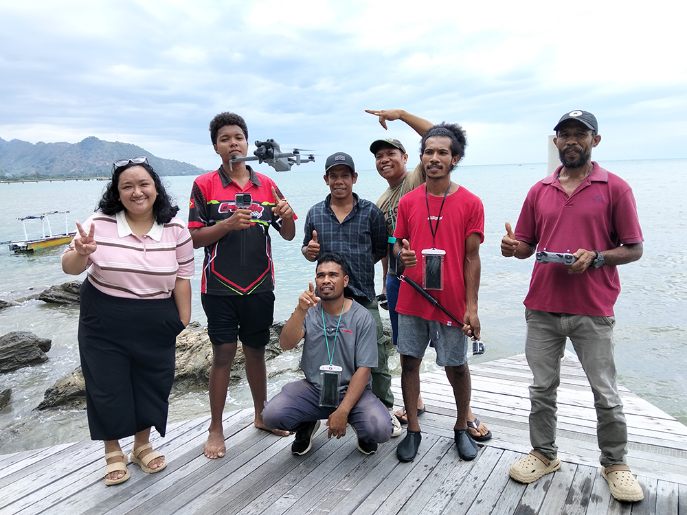
AP Hub and KFF during the training of trainers on open mapping tools, with sessions designed to be hands-on including practical activities and direct field application of the tools. Credit – Dinar Adiatma.
Monitoring for seagrass: Community mapping for coastal conservation in Timor-Leste
Along the Metinaro coastline in Dili, Timor-Leste, seagrass ecosystems play a quiet but vital role in supporting local livelihoods and biodiversity. Healthy seagrass meadows provide habitat for fish and other marine species that sustain and boost the local economy. They also protect endangered species such as dugongs, serve as natural barriers against coastal erosion, and help maintain clear waters so nearby coral reefs can flourish.
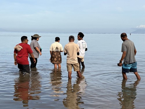
Key to the long-term health and sustainability of seagrass is understanding its condition and implementing regular monitoring. However, standardised and accessible spatial data on seagrass distribution is still limited. To address this gap, the ‘Monitoring for Seagrass’ project was launched by the Humanitarian OpenStreetMap Team’s Open Mapping Hub - Asia-Pacific (AP Hub) and Konservasaun Flora no Fauna (KFF). This project works with local communities to map and monitor seagrass ecosystems using open mapping tools and a participatory approach, strengthening conservation and community stewardship.
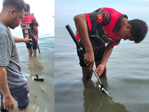
In March 2026, following the kick-off event in November 2025, AP Hub and KFF successfully completed a week-long training of trainers on open mapping tools. During these hands-on sessions, KFF learned to capture high-resolution aerial imagery using drones, collect field data through mobile applications, and create intuitive maps to visualise the data.
Credit – Harry Mahardhika.
“Prior to this, the monitoring we did was manual. We usually conducted transects and direct observations, manually noted the data on paper, and then input it into our laptop. The tools we learned are very helpful because they will make it easier for us to collect and process seagrass field data moving forward,” shared Patricio Ximenes, KFF’s Project Officer for Seagrass.
"The tools we learned are very helpful because they will make it easier for us to collect and process seagrass field data moving forward.”
In the coming months, KFF will transfer these newfound skills to more local organisations, training and preparing them to carry out collaborative mapping activities in the second half of the year. This knowledge sharing will be instrumental in strengthening digital appreciation and literacy – supporting the transition from well-established manual methods to a more digital workflow.
Through locally-led efforts, the project is set to not only generate Metinaro’s first baseline seagrass data, but also to produce maps and data that are grounded in local knowledge and ownership.
With the initial training activities already in motion, a future where seagrass conservation in Metinaro is guided by community-collected data is now one step closer. The team looks forward to diving into more milestones with local communities as they lead the mapping, monitoring, and safeguarding of their seagrass ecosystems.
Written by Tony Liong, Dinar Adiatma, and Honey Fombuena. For more information on this Darwin Initiative Innovation project DARNV028, led by Humanitarian OpenStreetMap Team, click here.